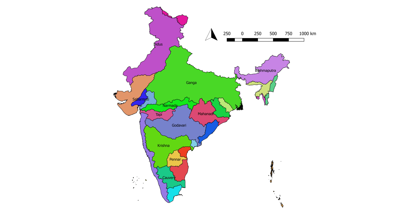
Map showing Major River Basins in India
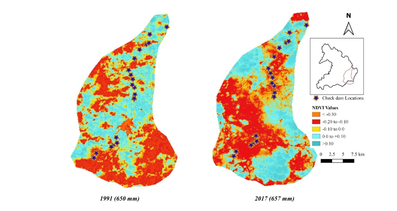
NDVI change between 1991-2001 in Khan Basin.
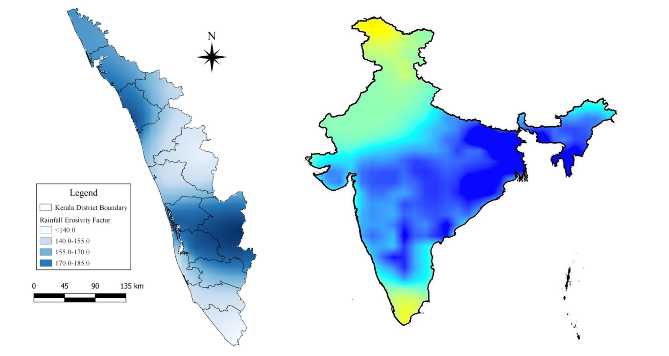
Spatial Variations in Rainfall Erosivity (R) for Kerala during Floods in 2018(Left), Average Ground Water Status in September 2019(Right)


QGIS (Quantum GIS)
QGIS (Quantum GIS) is a free and open-source desktop Geographic Information System (GIS) application.
It has features that support viewing, editing, and analysis of geospatial data.
QGIS is a cross-platform application (works on Linux, Unix, Mac OSX, Microsoft Windows and Android).
It allows users to analyse and edit spatial information, composing and exporting graphical maps.
QGIS supports both raster and vector data formats. Vector data is stored as point, line, or polygon features.
Raster images in various formats are supported, software can also georeference images.
It also allows use of data from external sources and Web services, like Web Map Service and Web Feature Service.
QGIS integrates with other open-source GIS packages such as PostGIS, GRASS GIS, and MapServer.
Plugins written in Python or C++ extend QGIS's capabilities.
Plugins can geocode using the Google Geocoding API, perform geoprocessing functions, which are similar to the standard tools found in ArcGIS, and interface with PostgreSQL/PostGIS, SpatiaLite and MySQL databases.